


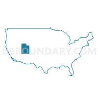
Cache, Summit, Morgan & Rich Counties PUMA, Utah
About
Outline

Summary
| Unique Area Identifier | 194245 |
| Name | Cache, Summit, Morgan & Rich Counties PUMA |
| State | Utah |
| Area (square miles) | 4,752.26 |
| Land Area (square miles) | 4,674.49 |
| Water Area (square miles) | 77.76 |
| % of Land Area | 98.36 |
| % of Water Area | 1.64 |
| Latitude of the Internal Point | 41.26973160 |
| Longtitude of the Internal Point | -111.31259990 |
Maps

Graphs
Select a template below for downloading or customizing gragh for Cache, Summit, Morgan & Rich Counties PUMA, Utah


Neighbors
Neighoring Public Use Microdata Area (by Name) Neighboring Public Use Microdata Area on the Map
- Davis County (North)--Layton, Clearfield, Kaysville, Syracuse & Clinton Cities PUMA, UT
- Davis County (South)--Bountiful, Farmington & North Salt Lake Cities PUMA, UT
- Salt Lake County (East Central)--Murray (East), Holladay Cities & Millcreek PUMA, UT
- Salt Lake County (Northeast)--Salt Lake City (East) PUMA, UT
- Salt Lake County (Southeast)--Sandy (North), Cottonwood Heights & Midvale Cities PUMA, UT
- Sheridan, Park, Teton, Lincoln & Big Horn Counties PUMA, WY
- Southeast Idaho--Pocatello, Chubbuck Cities & Fort Hall Reservation PUMA, ID
- Southeast Utah & Uintah Basin Region PUMA, UT
- Sweetwater, Fremont, Uinta, Sublette & Hot Springs Counties--Wind River Reservation PUMA, WY
- Tooele & Box Elder Counties PUMA, UT
- Weber County (East)--Ogden (Southeast) & South Ogden Cities PUMA, UT
Top 10 Neighboring County (by Population) Neighboring County on the Map
- Salt Lake County, UT (1,029,655)
- Davis County, UT (306,479)
- Weber County, UT (231,236)
- Cache County, UT (112,656)
- Box Elder County, UT (49,975)
- Sweetwater County, WY (43,806)
- Summit County, UT (36,324)
- Wasatch County, UT (23,530)
- Uinta County, WY (21,118)
- Duchesne County, UT (18,607)
Top 10 Neighboring County Subdivision (by Population) Neighboring County Subdivision on the Map
- Ogden CCD, Weber County, UT (208,109)
- North Davis CCD, Davis County, UT (197,425)
- South Davis CCD, Davis County, UT (109,054)
- Logan CCD, Cache County, UT (78,094)
- Brigham City CCD, Box Elder County, UT (26,864)
- Park City CCD, Summit County, UT (24,696)
- Tremonton CCD, Box Elder County, UT (19,959)
- Evanston CCD, Uinta County, WY (14,613)
- Smithfield CCD, Cache County, UT (12,379)
- Heber City East CCD, Wasatch County, UT (9,965)
Top 10 Neighboring Place (by Population) Neighboring Place on the Map
- Logan city, UT (48,174)
- Smithfield city, UT (9,495)
- North Logan city, UT (8,269)
- Summit Park CDP, UT (7,775)
- Hyrum city, UT (7,609)
- Park City city, UT (7,558)
- Providence city, UT (7,075)
- Snyderville CDP, UT (5,612)
- Nibley city, UT (5,438)
- Hyde Park city, UT (3,833)
Top 10 Neighboring Unified School District (by Population) Neighboring Unified School District on the Map
- Granite School District, UT (385,194)
- Davis School District, UT (306,479)
- Canyons School District, UT (204,224)
- Weber School District, UT (148,422)
- Cache School District, UT (64,634)
- Box Elder School District, UT (49,975)
- Logan School District, UT (48,022)
- Park City School District, UT (24,401)
- Wasatch School District, UT (23,530)
- Duchesne School District, UT (18,607)
Top 10 Neighboring State Legislative District Lower Chamber (by Population) Neighboring State Legislative District Lower Chamber on the Map
- State House District 31, ID (45,173)
- State House District 5, UT (43,319)
- State House District 54, UT (42,563)
- State House District 18, UT (39,762)
- State House District 27, ID (38,757)
- State House District 3, UT (38,268)
- State House District 20, UT (38,155)
- State House District 53, UT (37,757)
- State House District 2, UT (34,283)
- State House District 25, UT (34,235)
Top 10 Neighboring State Legislative District Upper Chamber (by Population) Neighboring State Legislative District Upper Chamber on the Map
- State Senate District 17, UT (102,922)
- State Senate District 26, UT (101,392)
- State Senate District 19, UT (91,855)
- State Senate District 25, UT (89,262)
- State Senate District 22, UT (89,061)
- State Senate District 23, UT (87,939)
- State Senate District 7, UT (79,585)
- State Senate District 18, UT (79,560)
- State Senate District 8, UT (74,996)
- State Senate District 31, ID (45,173)
Top 10 Neighboring 111th Congressional District (by Population) Neighboring 111th Congressional District on the Map
- Congressional District 1, UT (906,660)
- Congressional District 2, UT (890,993)
- Congressional District 2, ID (725,652)
- Congressional District (at Large), WY (563,626)
Top 10 Neighboring Census Tract (by Population) Neighboring Census Tract on the Map
- Census Tract 9405, Wasatch County, UT (8,614)
- Census Tract 9701, Morgan County, UT (8,042)
- Census Tract 9753, Uinta County, WY (7,761)
- Census Tract 3, Cache County, UT (7,492)
- Census Tract 6, Cache County, UT (7,068)
- Census Tract 2.02, Cache County, UT (6,953)
- Census Tract 2101, Weber County, UT (6,942)
- Census Tract 9602, Box Elder County, UT (6,901)
- Census Tract 9754, Uinta County, WY (6,852)
- Census Tract 9702, Franklin County, ID (6,718)
Top 10 Neighboring 5-Digit ZIP Code Tabulation Area (by Population) Neighboring 5-Digit ZIP Code Tabulation Area on the Map
- 84321, UT (44,074)
- 84121, UT (41,702)
- 84403, UT (36,582)
- 84109, UT (23,858)
- 84302, UT (23,703)
- 84108, UT (20,738)
- 84341, UT (20,109)
- 84098, UT (17,282)
- 84032, UT (17,249)
- 82930, UT (14,614)